April 15, 2012

Travelling to Taipei

Here is a short overview of our trip to Taipei, from March 24th to the 3rd of April 2012. We were there because of the channel called Leokong and the water, and what it embraces, connects to and from where the senses and knowledge are sourced from. 
Six out of eight our group members, and our tutor Marco Casagrande travelled to Taipei. Thanks to our helpful guides Yu-chen and Frank, we found ourselves in the most interesting and hidden places of the city. 


Day 1 (click on pictures to see them in a bit bigger scale)
Starting from the end point of our plan of the channel - we are lined up in front of the yellow fence, which is a separation between us and a huge space of abandoned military area - a promising place to create a solution for the end usage of the channel´s water. 
Throughout the trip we managed to see a particular and special culture of Taipei City - community gardens - located randomly, often illegally, by the ´first generation´ of Taipei, people, who remember how the waterways were the main source of living and means of transportation - partly they have carried the lifestyle and traditions with them, which explains the existence of the gardens as a source of local knowledge and hidden potential to create linkages between young and old generations, developing a more sustainable living environment in the industrialized city's circumstances. The garden depicted in the pictures above is located in the very center of the city, nearby Taiwan´s World Trade Center and the landmark of the modern city - Taipei 101 Tower. A concept of urban nomding can be experienced in Ruin Academy, fragment in the below-left corner. 


Day 2
Tracing the history of the channel - single parts (filled) of it what we detected together with NTU student and researcher Douane, in the area of National Taiwan´s University. Streetview in below-left depicts the location where channel was not more than 30 year ago 20 meters wide. 
In the quiet street nearby the area of small cafes, there is an individual part of the channel. Behind the green fence used to be a community garden, which now awaits real estate developers, though it would be a great location for open greenery area.


Day 3
Wednesday started with exploring the source of the channel - nice renovation which continued as an open sewage. 
Walking from that on towards Treasure Hill, we discovered a huge area of greenery - people who lived in nearby houses keeping a garden, but also, a big natural area - it gives a fresh breath inside an industrial city of 2.7 million people. And, a small picture of eggs - they seemed to be almost like a national food - anyone who visits Taipei will grasp that.


Since we managed to go to Treasure Hill in each abovementioned day, here is collage of that place. Marco, who most likely knows all the details of enlivening this place up, is introducing the area. A grassfield that is now mainly for tourists used to be farming area, which has now remained in a very small scale.


Day 5
Our fifth day started in Tamkang University by architecture students who are also investigating the Leokong Channel and presented us their approaches and solutions for that. Very nice to meet them, thanks for their time and participation. 
We continued to visit another community garden, which is said to have traditions in urban farming dating back to the beginning of the 20th century. Located on an island, inbetween two bridges near the Xindian river in the heart of the city, it gives the place a special atmosphere - hopefully an area which will never be full of concrete houses, but seen as a promising case for sustainable city development. Gardens have strict rules of owning the plots, which are visible for everyone entering the gardens from the bridge - on the wall, in black and white - no misunderstandings. 
In the afternoon, we had a pleasant opportunity to meet professor Rouan, who introduced us to the work of great architect Hsieh Ying-Chun, exhibition which was curated by him. Not less memorable is the evening that followed - discussions about anarchy, love and urban ecopuncture, and a piece of performance of Taiwanese literature. The most tireless ones continued with the sauna in Ruin Academy, probably the most unique sauna in Taipei. 


Day 6
On Saturday we took a boat trip on Xindian river to visit Guandu fishermen village. Once placed walls near the river banks for controlling the water flood are visible in their size here. The small open places have access for entering a boat - not anything more people can and are able to do with the proximity of river water in Taipei.  


On the remaining days we investigated more precisely the area of the channel, as predicted, many surprises occured, as well changes we had planned beforehand. Here are some streetviews and images of the places near what our planned channel would flow, and the starting spot of the water takein from the river to the channel (picture above left). More of them can be seen in our report of the project. 
When looking at the pictures here to depict our research, I realized that they lack somewhat the noisy atmosphere of the existent city - below is collected some of them to convey that, if that could be conveyed at all :).  


These were some moments we tried to capture here, of course far not all our experiences are described here - the night markets, geological park, Drunken Moon Lake, cafes, museums, splendid experiences of food and manymany things that made the trip so special. To develop projects like this one, we all agreed that, field trips are essential part of the work, and not only for realizing set locations and tasks of the projects, but getting an overview and understanding of the local culture, people and environment. Special thanks to Marco for keeping this scale projects alive, Yu-chen and Frank for their help and contribution to the trip and project.




April 14, 2012

Thoughts about the channel during and after trip to Taipei + direction of change

* channel should appear as a sensitive part of the city
(as a contrast to geometric urban concrete environment)
>  sensitive touchable materials(wood) + image(soft organic shapes) + water surface lifted to the visible level  = people will notice, respect and take care of the channel more than now.
// now open parts of the channel are made of concrete and placed 2 meters bellow the walking level, so the citizens don´t see or have any contact with water and it is easy to throw the rubbish there //


technical/functional things

*channel can be made in 2 layers ( one underground/under roads as it is now and another one approximately on top of it but visible and sensitive on the reachable for people level)visible part of the channel will follow the "rules" of environment -  going above, around, inside the existing structures


*in some parts the visible and sensitive channel could go into the street structure, inside the first floors of buildings near the channel(half-outdoor shops and other companies working with open to the street facades) > for building- and landowners this system (investing or having a public space inside their territory) can be a benefit in relationships with government
= benefit for public + benefit for owner


*as thought before the trip, the water-land lakes(some of them) could be lifted few meters above the ground level > economy of the space + creating a shadow place for park visitors


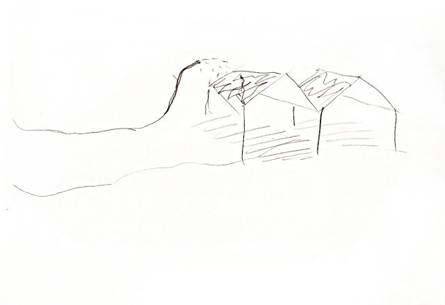
            sketch of concept for all area
            final use> park> hills + water snake    

final use, urban-farming on the roofs of ex-military buildings
(inside the buildings can be a concert hall,night-market,workshop place...)
Final use, hills, snake waterfall(1001 on the horizon)

     
     Parts of the sensitive channel made from wood>


April 12, 2012

Elevation challenges


The flow of the original course of Leo Kong Canal was based on gravity, but since we decided to focus on only one part of the old canal, we had to find an alternative course for part of the project area. Since we cannot trust that there is any reliable flow through the existing underground canal, we thought we could take water from the river a bit further downstream compared to the original canal.

The trip to Taipei revealed some technical challenges and one of them was that the chosen course of the canal was blocked by a military area and that, what used to be an open space, now is a construction site. This meant that we had to expand the area in order to be able to treat the water taken from the river appropriately. 

The new addition to the area, marked orange in the map below, was chosen for its park that could be converted to contain a wetland. However, there is an issue with the elevation differences of the area. 

 
This map points out the highest point along the flow, in the red circle. A solution has to be found for getting the water from the river to the highest point (in the red circle), but still be surfaced, as this area (marked with orange) is the most suitable for wetlands due to restrictive space available in the area that tilts the right way (market green).


The sketch below is a suggestion for the first part of the canal that will take the shape of a wetland area on the river bank. We do not yet know how often floods reach the height of the flood wall, but we do know that there are plenty of recreational areas on the flood bank, such as a small golf course and other sports facilities. This gives us the motivation to put a wetland here despite the risk of floods. Still, the structure should be designed either to withstand a flood or two in its lifetime, or to be rebuilt easily after a flood.

So far, the solution consists of a submersed pump of some kind that takes water from the river and pumps it into an underground aeration tank. Another pump will transport the aerated water to a gravel filter, which will reduce the amount of bacteria and other microorganisms in the water before letting it into the wetlands.


Once on the other side of the flood wall, we still need to elevate the water further, as the park where we would like to continue the wetland area to continue is tilting the wrong way. A first thought of how to solve the problem is shown in the sketch below.

The water would be pumped into the first pond, which is above ground level. As the water flows along at a small decline, the ground level approaches the water level. Somewhere in the middle the water and the ground level will be the same and at the end, the wetland will be in a bit of a valley, where the ground level is higher than water level.


Sewage studies

 There is some parts of the LeoKong channel which still exist. This is the longest of the existing parts used as open sewage.


Channel is used as dump for all sorts of dust

Moving along the channel insists acrobatic skills
Petrol into water reflects the city. There is a risk to get a sewage water shower straith from someones kitchen.
It is difficult to reach the water. As people don't have water connection, they don't care about the quality of water


April 9, 2012

Original channel goes around the hill


Some thoughts after the Taipei excursion

Walking along the channel

The group walked whole way along the channel from the river bench to the former militar area. We were facing many surprises during the walk especially in the beginning of the channel where the cleaning pools should have been located.

Some surprises

-    closed(active) military area blockin some part of the channel.
-    topographical difficulties causing extra pumping – hill on the way
-+  smelly cow farm on a way
+ - new university building on construction just where we should have had a pool
++ river park maybe possible to use for water cleaning purposes
++ possible to connect river biking ways into the city along the channel – water gate to the
 flood wall
++ wonderful, multi-usable and architecturally valuable old military halls into the former military    area


Observations of the social environment in Taipei

The general social environment of Taipei feels totally different compared to Finnish one. Some of the basic factors effecting lifestyles of citizens as political situation, historical relations and climate conditions differ from ours. Differences are very visible in sociaty.

Even the Taiwanese government is strong authority governing public issues, people are considerable free to show their existance as a part of the city. The whole city is full of small scale visible transformations carried out by citizens. By transformations I mean for example gardens filling the unbuilt areas, signs and small shops everywhere and parasite building parts fastened randomly to facades. Even colourfull umbrellas hanging from a fence are signal of this local activity. The whole city environment is a collage of these small scale transformations, which together form the Taipei city. This remarkable small scale social potential must be considered in Leokong channel planning process.

People’s notable non-govermental activity grows from the fact that they are considerably less banded to municipal system than Finnish people. Finland has a very precise system of regulations, how to live correctly in the sociaty. Also city planning system is very controlled. Finnish system is controlled in flexible way so that people have some kind of possibilities to effect their own lifes trought the system. In Taiwan, the municipal system and sociaty are strictly separated. Municipal system takes care of the skeleton of the sociaty and citizens are forced to do the rest – or sometimes allowed to do the rest.


How to plan a city whose strenght is unplanned randomness?

The design we are creating is about bringing water to people - constructing a purely physical and artificial constructed water way into Taipei city. Could this physical design be transforming parametrically by the life of surrounding city? As  European designers we may shouldn’t try to guess, how the local knowledge could  be used as a part of our plan but rather just let the local knowledge use our plan as it wants and let the design live with it.

In Taipei, people don’t need to be activated to do gardening or other kind of urban activities, because in Taiwanese social system they do it by nature. This urban activity obviously transforms the environment. Our design must be done so, that it transforms by this random local activity and especially don’t destroy the possibilities to practice it. If the city spaces become too controlled, there is a risk that local activity disappears. Many urban activities such as gardening are done by relatively poor and old people and controlled systems use to need funding.

From Finnish viewpoint, it was amazing to see how Taipei people used all the free space for their own ideas and even plants were growing out from concrete using all the possible space in very dence city. All we have to offer by our urban design is that small gap in the concrete wall the plant grows from or alternatively the small space in the city urban culture can grow from.

Another local parameter transforming the channel area is time. Nowadays the city is continuously growing upward. The lowest buildings are the oldest and newest are the highest. The old and low buildings are continuously replaced by new and high ones. Large contruction companies buy old houses to collapse them and to build new instead. How this urban development would be related to the channel? How would the LeoKong channel transform when the surrounding housing areas are step by step reborn?

April 8, 2012

Heat Island Effect

We have been thinking about heat islands, and how to counteract their effects on the project area by our design.Here is a short description of the heat island effect:

Densely populated areas tend to be warmer than their rural surroundings, which is called the urban heat island effect. The mean temperature in a city of a million people or more can be up to 3 degrees warmer than its surroundings during a year. There are a few reasons for this phenomenon which in combination creates these huge temperature differences. The sun can heat dry, exposed surfaces to temperatures higher than the surrounding air, which occurs mainly on man-made materials such as brick, metals and asphalt, as opposed to grass fields. The lack of shading by trees and other organic components also emphasizes the heat island effect. In areas with tall buildings, the sunlight is reflected and absorbed by multiple surfaces, which means that the energy stays in the area for a longer time compared to flat ground surfaces that are in direct exposure to the atmosphere. Lack of vegetation (cooling of air by evapotranspiration) in urban areas also increase the effect and variations in heat conditions can vary between landcover types even within a city. 

(Baumann, P. (2009). Urban Heat Island Lesson. Geocarto International , 473-483.)


In the project we are trying to consider which materials to use, to expose the water of the canal to the city also in terms of irrigation of parks, agriculture and maybe even individual trees, shading of surfaces of different kinds and designed natural ventilation of houses. It is a working process, but these are some of the ideas we have had so far.