March 20, 2012

THE PARADISE ISLAND, park and channel examples

the island could be combined with urban farming idea - place for everybody - free land

another 2-lewel park


                                                                      channel examples

sketches for concept developing

waterfalls - the sound of water would be nice element and the water will be more visible in vertical lewel
water+shadows
café or tea-room can be arranged under the water shalter
URBAN-FARMING PYRAMID with water coming from the top of it 
+ possible apartments or activity inside


assosiation to yesterdays discussion/thoughts about 2 level urban environment...life in shadow, under the buildings + vintilation

                     Constant’s New Babylon

                                           http://benandjess.wordpress.com/2008/12/02/constants-new-babylon/
                                           http://aire-ville-spatiale.org/la-ville-spatiale-de-yona-friedman-the-ville- spatiale-of-yona-friedman/


March 18, 2012

In the middle of a day (13pm), the shadow of a house is from 25% to 115% of the hight of the building


 Alluvium (yellow) = Gravel, sand and clay from holocene period

March 10, 2012

Some ideas for the visit to Taipei

Here is the list of things we wanted to investigate when in Taipei:
  • Walk along the length of the channel that we plan to open
  • Visit the sites where the channel is currently opened 
  • Investigate the areas around the channel: is the army area empty -more room for wetland?, which areas are owned by the university/government? etc
  • Visit existing communities: those who manages green spaces and urban farming, fishermen etc
  • Visit the university the channel goes through - what do they think of the project?
  • Map out current green-projects in Taipei
  • Find out about diversity of young people's relations to nature
  • Talk to Taiwanese architecture students from the university - what is their mindset? how do they work?
These two might be harder to do, but we are still keeping them in mind:
  • Find out about how real estate values could change with if the project would be realized 
  • Visit the wetland in Kaoshuing

Still some open parts of the channel existing

Before Leo Kong channel system covered almost whole Taipei, but nowadays it´s more or less filled, so as the part we are focusing on. However, there are few spots, where channel is still open. Those parts are mainly just tributaries, but from pictures below you can get some picture how it was before. During our field study in Taipei we are also going to explore these sites in addition to the part we are planning to open. This gives us some picture and idea of the main channel which is underground below roads and that´s why quite difficult to explore. Pictures are taken from google maps street view.
 Open parts of channel are illustrated with blue colour and main channel with red. 


Open_channel_1; This section is relatively short, approximately 100 meters, but there is still some water flowing.
Open_channel_2; This part is even shorter, about 50 meters long.


Open_channel_3
Open_channel_3; this part is almost 300 meters long.

ShinShan_gutter
ShinShan gutter is 1,9 kilometers long. There is highway above it. 


March 8, 2012

After Local Knowledge

"Bringing water to people and people to water" as we stated in our first presentation about our work concerning the Leokong Channel and opening it up in Taipei City, we are looking into very complex situation technically, environmentally, economically and socially. Our goal is to plan to open up some parts of the channel to enable citizens of Taipei the proximity of water that would be clean enough (for agriculture and other maintenance usage). 


Conception of water as inherent part of nature differs largely among the generations in Taipei City as the totalitarian regime alienated people from the river water by building 12 meter high walls along the river banks to control the floods of the river water. Rivers got polluted, people started to use them as dumping locations; former Leokong channel were filled and used as a sewage system. Young generation of Taipei take rivers as a source of disease, the industrialism has had a strong affect on them in terms of appreciating nature and co-existing with it in an urban environment. 


That makes the project a very interesting one as we do not only deal with technological problems of how to purify the water, in addition to how to use it, how to create the understanding of nature's natural circulation, by not establishing an amusement park for people, instead of creating a process/concept/system of action where people could get involved of developing a more sustainable living environment. Planning as sustainable technologies as possible it is relevant to see sustainability as the basis of the whole development of the project. Besides being environmentally sustainable, we try to create approaches that are driven from social contexts that embraces understanding of Taipei people's culture and their behaviours. 


Regarding to the information, Taipei people comprise of very different backgrounds and experiences concerning the comprehension of existing together with water in the city. Old generation of citizens remember how the waterways were the main source of living, means of transportation, moreover the water was clean enough for drinking - they have carried a part of that lifestyle and traditions with them, which explains, why Taipei is filled with plenty of community gardens (often illegals), surviving under industrialized city's circumstances. These people are an essential part of observation and research, whether it is possible to create linkages between the old and young generation, their so different lifestyles and conceptions of nature, so that a platform of new experiences and emotions of co-creation and interaction with environment as well with other individuals are enabled. 


Making Taipei Cooler

Using the channel for source of cooled water in order to cool the buildings above on the ground could provide a source to improve value of the real estate in close areas of channel. This could be used to collect money from the public to finance the project.

March 7, 2012

Biofilm and biofilm carriers


We have discussed how the water could be cleaned from the majority of coliform bacteria before it enters the channel, to reduce the risk involved with touching the water as well as the smell. One suggestion was to try and make a sub surface treatment with biofilm carriers before the water is released into the channel. Here follows a short, relatively technical, description of biofilm and biofilm carriers. 

Biofilm is a protecting surface (sometimes called slime) for a cluster of microorganisms, for example bacteria. Biofilm is often associated with sicknes but it is very important in wastewater treatment applications. In order to optimise the surface area of biofilm in a waterbodies, like treatment pools, carriers can be used. The carriers come in various shapes and sizes, all to try and optimize the number of bacteria that can sufficiently treat the water in question. The microorganisms extract and digest organic compounds from the water. Bacteria remove organic matter and microorganisms like protozoa and rotifers maily focus on suspended solids, pathogens and other microorganisms. Water is ultimately clean when there is nothing left for the microorganisms to process and then the biofilm goes away.

Biofilms also naturally occur in waterbodies on ricks, pebbles and on macrophytes growing in the water. It the water becomes stagnant there can even be biofilm on the water surface. Biofilm fits into the ecosystem as food for aquatic invertibrates, which are in turn fed on by fish.

Technology Related to the Leo Kong Channel


      -some issues and some solutions


Water Quality of the Leo Kong Channel
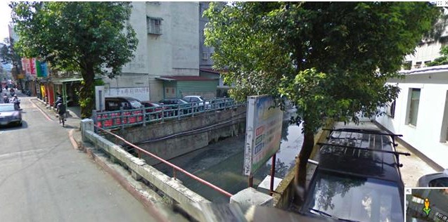
One of the main problems with opening up the Leo Kong channel is that the water flowing through the rivers of Taipei is polluted. The channel starts form the orange X in the picture below and the channel is marked blue. The light blue markers show four bridges that are measuring points for the Environmental Protection Administration in Taiwan.

The water quality values for the four sites on the map can be found in the tables below including the water quality standards set by Environmental Protection Administration.

The orange cells of the table above shows which values exceed the water quality standards for class A waters, which means that suspended solids, biochemical oxygen demand, nutrients (nitrogen and phosphorus) and bacteria need to be reduced for the water to be advisable for people to swim in. Some of the values measured are not even sufficient for public water before sufficient cleaning by Taiwanese standards. If the water is not treated, it can still be used for raising trout, sweetfish, perch, carp, grass carp and mollusks. The lower quality water is also allowed in manufacturing and as cooling water. 


The next table below shows the values for metals in the water and the standards for protection of human health. The levels are all below the limit for human health, which means that the water can be used for agriculture in terms of toxicology.


The Kaoping River Rail Bridge Constructed Wetland
A similar project has been done in Kaoshiung City, the second biggest city in Taiwan. The wetland was commisioned in 2004.


The wetland has two systems, one with incoming water from a paper mill and the other from local drainage systems containing untreated domestic, agricultural, and industrial wastewaters. Below is an overview of the constructed wetland, and the lower system (B1-7) is the one that is interesting for the Leo Kong channel project. The system consists of a series of meandering bits of river and ponds for nutrient and suspended solids retention. The red and blue arrows indicate flow directions within the systems.

This table shows some water quality values for the wetland, system B is marked. These data can give an indication of what would happen with the Leo Kong channel values after a similar treatment. The values show that the wetland works very well for reducing coliform bacteria and phosphorus when considering the efficiency expressed in percent. This means that there is hope for treating the Leo Kong channel water relatively successfully. The water in the Kaoping wetland however, does not meet the stringent water reuse standrads, even if the water quality is significantly improved.


Design of a Constructed Wetland
One very important part of nutrient retention as well as treatment of bacteria is the flora that is put into the system. These are some examples of plant species that are commonly used in constructed wetlands.


For the Leo Kong channel however, we are mainly interested in native plants to Taiwan to enhance and support the native flora and fauna and to prevent introduction of species that can be dangerous to the existing ecosystem.


There are several ways of integrating plants in wetlands, ponds, rivers and streams. Here are a couple of examples of how plants can be integrated in innovative ways.

 
Other techniques involve collection of sediment in the water, like a sub surface sediment trap shown below. It can be designed so that all water has to pass through it or so that some of the water is still allowed to pass over the top and into a waterfall. 
Waterfalls are not just pretty, but they also help aeration of the water, which increases the amount of dissolved oxygen in the water. 

The sketch below shows two versions of a weir. This system helps for flood control and stream regulation. The weir can be designed after preference, for example so that is always lets through a certain amount of water at low flows but a higher amount at larger flows or the other way around.

A good way of improving the habitat of fish and other fauna is to place boulders in the bottom of a stream for example in a bend, which breaks up the flow of the stream. A cluster of boulders or small islands can also be beneficial in a pond or a wetland.
 
The Leo Kong channel will pass through some more populated areas with shops etc, where the streets must get enough space and where the river should still be visible. Designs similar to the ones below allow contact and closeness to the water without compromising safety. With foil underneath the channel, the water cannot go anywhere but downstream and concrete and other materials suitable to the area can assure that there will be no erosion so that the streets and the traffic is protected.


Open blog about opening the channel

The Blog
Life canal blog is now open for public! The goal of this blog is not only present the planning data of the Leokong channel opening plan made in Aalto University but also share the groups planning process with all the other people related to this project in Taiwan and Finland.

Some background
The Leokong channel project is part of a Studio Global Sustainable Technologies at Aalto University. The project is carried out in co-operation with Taiwanese JUT Foundation for Arts & Architecture and the Ruin Academy. The goal of the project is to research the possibilities to open an old irrigation channel, LeoKong, and bring clean water to Taipei city people. Nowadays the channel is underground and mainly under streets.
The group has been analyzing the city and planning area from urban, social, spatial and economical viewpoints. We have been studying water technology and exploring the academic context of the plan as a part of Taipei river urbanism and thinking how to make our project sustainable transformation project.  The sustainable attitude towards the existing city is very essential for this project because the channel goes inside the dense Taipei city center. We don’t want to destroy the city or make citizens life difficult, but create new quality in to the old city areas.


Taipei is located just between two tectonic plates.

The water cycle
At the moment we have an overall concept plan about the water cycle. We have 3 stages of water usage. Each of them relates to certain city environment. Water flows from south to north and National Taiwan University would work as filter cleaning the river water.
When the channel goes in to the dense Liuzhangl city area it gets more narrow and form channel streets. Al the commercial (and logistics) around the channel street is maintained. The channel is part of urban city, but it still has smaller cleaning and cooling effect.
We don’t want to let the cleaned water go back to the dirty river so we have a final water use. Water goes in micro-scale water systems. New housing grows from the water and maybe also the old housing would be transformed by water.


The context


The group
The group consists of master students from Finland, Sweden and Estonia. All the students are from different fields of studies, so the group should be multinational and multitalented. Architect Marco Casagrande is tutoring the group. We have also Taiwanese contact persons as Yu-chen Chiu from ruin academy who shares her local knowledge.

March 6, 2012

more skatches

                        channel+natural forms (mini mountains, trees and coi-fish pool, water-shower)
                        in some parts the channel could be covered by glass(keeping function of the city as before)

                                         in the end of the channel(where water is already quite clean), the water can be
                                         used for urban farming.
                                         A big "pyramid" for urban farming with the water-shower on the top,
                                         coming down... A WATER PARK WITH SHADOWS AND
                                         WATERFALLS
                                         iside the pyramid could be a parking hall/ gym/hotel
                                         ...idea in prossess

first sketch for concept of the environment of opened Leo Kong Channel